Ask someone from out of town where Point Pleasant is, and they'll picture the boardwalk. The Ferris wheel. Jenkinson's aquarium. The arcade lights reflecting off wet sand at ten at night. That's Point Pleasant Beach, a separate borough a mile south, and the confusion is understandable because the two towns share a name, a zip code, and a river between them. What they don't share is an economy. This winter, New Jersey's Department of Transportation ran an accidental experiment that proved it.
A Bridge Comes Down, Nothing Else Does
Beginning at 9 a.m. Monday, January 5, the Route 13/Bridge Avenue Bridge over the Point Pleasant Canal was closed and detoured in both directions. The closure was necessary to make priority repairs to re-tension the support cables on the bridge, which was built in 1971. Crews erected two shoring towers on the road to do the work. The closure stayed in place until late February 2026. That's roughly seven weeks with the borough's main artery over the canal shut down in both directions, during the dead of a Jersey Shore winter when patience for detours runs thin.
Here's the part that matters for anyone who actually lives here rather than visits: local access for businesses and residents was maintained on Route 13/Bridge Avenue. The state didn't need to reroute daily life around the closure because Bridge Avenue's commercial strip was never built to depend on beach traffic passing through it. It runs on its own customers.
What Bridge Avenue Actually Runs On
The borough's main street is where independent shops, cafes, and everyday services anchor a walkable downtown that locals depend on year-round. That's not a slogan, it's a description of what's actually there. On any given afternoon you'll find:
- El Guacamole, an authentic Mexican restaurant on Bridge Avenue that's become one of the corridor's standing fixtures
- OceanFirst Bank's Bridge Avenue branch, wedged between a Bubbakoos, a Dunkin, and an Oakwood Pizza, the kind of intersection that only exists because people actually walk between them
- Community Park, tucked right off Bridge Avenue with softball and soccer fields that fill up with youth leagues every spring
None of that needs a tourist. It needs a resident who's picking up dinner on the way home from work, which is a different kind of commercial district than the one a mile south that lives and dies by summer weekend traffic.
The River Sets Its Own Calendar
While Point Pleasant Beach's summer calendar bends around tides, boardwalk hours, and beach badge season, Point Pleasant Borough's biggest annual outdoor event doesn't touch the ocean at all. On Sunday, September 27, 2026, Riverfront Park hosts the DQ Treasure Island Sprint Triathlon, Duathlon, Aquabike, and Kayak Triathlon, with every event starting and finishing at the park itself. The course runs out and back along River Road, loops through Chatham Lane, Barton Avenue, Allen, and Osborne before funneling back into the park, a route that only makes sense if you already know these streets by name rather than by GPS.
Racers who need a boat can rent one nearby: FROG Canoes & Kayaks is a veteran-owned business offering canoe and kayak rentals in Ocean County. It's a small detail, but it says something about the town's relationship to its own water. This isn't a beach community that tolerates a river running through it. It's a river community that happens to be a few miles from a beach.
Riverfront Park itself sits at 2303 River Road, and if you've lived here more than a summer, you've probably already walked, biked, or launched a kayak from it without thinking twice.
A Boater's Town Before It's A Beach Town
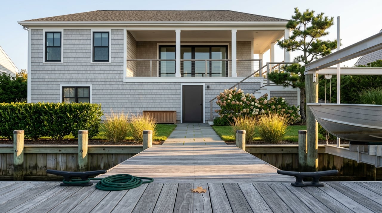
Drive the canal side of town and the density of marinas tells the same story as the triathlon course. Shore Haven Yacht Club, Crystal Point Yacht Club, Clarks Landing Yacht Club, and Canal Point Marina all sit within a short stretch of water, and Safe Harbor at Crystal Point runs a fuel dock around the clock for boaters heading out early or coming back late. That's not incidental infrastructure. It's the actual center of gravity for a meaningful share of the households here, people whose calendar runs on tide charts and marina schedules rather than beach badge season.
This is worth sitting with for a second, because it reframes what "living near the water" means in this particular borough. It's not oceanfront. It's canal and river frontage, working docks, boat lifts, and a fuel dock that never closes. Different water, different rhythm, different kind of neighbor.
Small Enough To Know Its Own Address
Point Pleasant Borough is a community of roughly 18,900 residents with a walkable downtown and strong civic life, and that scale shows up in how the town runs its own events rather than outsourcing them to a bigger neighbor. The Point Pleasant Borough Chamber of Commerce runs Summerfest in the Park every year, and it's a big enough draw that the OceanFirst branch on Bridge Avenue participates every year with food trucks, live music, and other activities. A bank branch showing up as a recurring sponsor of a town festival is a small thing, but it's the kind of detail that only exists in a place where the business community and the residential community are the same handful of people wearing different hats depending on the day.
The borough's roots go back further than the bridge or the boardwalk rivalry. Long before European settlement, the Lenape people gathered here in an area they called the Land of Tall Timber, using it as a meeting place along the waterways of what is now Ocean County. The dense pine and cedar that gave the area its name eventually fed a logging economy that shipped timber down the creek system long before anyone was launching a kayak from Riverfront Park for sport. The water was always the point. The beach a mile away was always someone else's business.
None of this means the boardwalk doesn't matter to people who live in the borough. Plenty of residents walk or drive down for a slice or a ride on a summer night. But the two towns run on separate engines, and a seven-week bridge closure in the dead of winter proved it without anyone planning the experiment. Bridge Avenue kept serving lunch. The banks kept banking. The park kept filling with soccer practices. Nobody needed the boardwalk to stay open, because nobody on this side of the canal was counting on it in the first place.
If you're the kind of person who already knows which streets the triathlon closes every September, or which marina fits your boat better than the one your cousin uses in Brick, you already understand the distinction this post is making. If you're newer to town, it's worth knowing before you assume Point Pleasant is shorthand for the boardwalk. It isn't. It's Bridge Avenue, Riverfront Park, and a canal full of boats that never much cared what was happening on the sand.
For more on how this stretch of the Manasquan River compares to neighboring towns like Brielle and Manasquan, Sal Ventre keeps an updated set of neighborhood guides built for exactly this kind of local comparison. And if you're ever curious what a home along Bridge Avenue or the canal is actually worth in today's market, Sal's instant home valuation tool is free to use, no obligation, no boardwalk required.